


-

"Very nice Posters. The quality is amazing and we received it very quickly !"
-

"A shop to visit absolutely. Huge selection of posters. We spent more than an hour there !"
-

"Perfect to find gift. Price are very good. An they can frame and pack it on site"


About the Artist
The Institute of Leipzig represents the collaborative spirit of nineteenth-century German publishing, where editors, cartographers, and engravers worked together to advance geographic knowledge. Leipzig was renowned as a center for academic printing and mapmaking, producing works that served both educational and scientific communities. Rather than being attributed to a single artist, this map reflects the collective expertise of its creators, who sought to make complex information accessible to a wider audience.
Maps from this era were valued for their accuracy and clarity, bridging the worlds of science and visual culture. They became essential tools in classrooms, libraries, and the homes of curious minds, reflecting the intellectual ambitions of their time.
The Artwork
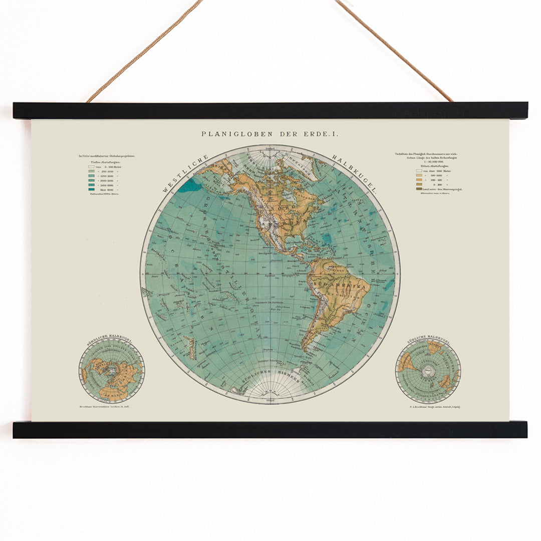
Planiglobes of the Earth I was created during a period when global exploration and the standardization of geographic data were transforming how people viewed the world. The planiglobe format, presenting the earth in two flat hemispheres, allowed viewers to compare continents, oceans, and routes with ease. This approach was particularly useful for education, navigation, and the growing interest in world geography during the mid-nineteenth century.
Published in 1860, this map embodies the era’s drive to catalogue and organize knowledge, serving as both a scientific reference and a cultural artifact. It stands as a testament to the period’s fascination with discovery and order.
Style & Characteristics
The map features two precisely rendered hemispheres, each surrounded by fine latitude and longitude lines. The seas are shaded in muted blue, while landmasses and labels appear in brown and sepia tones, all set against a warm beige background. Detailed typography and careful labeling convey a sense of scholarly rigor, while the balanced composition invites close study.
The overall effect is calm and refined, making this vintage print suitable for a range of interior styles. For those interested in cartographic design, explore more map prints or pair with beige wall art for a harmonious display.
In Interior Design
This vintage map print enhances home offices, libraries, or living spaces where intellectual curiosity is celebrated. Its neutral palette complements wood, brass, and leather furnishings, while its detailed design adds depth to minimalist or traditional interiors.
Consider pairing it with science themed prints to create a thoughtful gallery wall that appeals to travelers, historians, and design enthusiasts alike.